LiDAR Technology
Cutting-edge equipment that ensures maximum accuracy and reliability.
LiDAR Technology
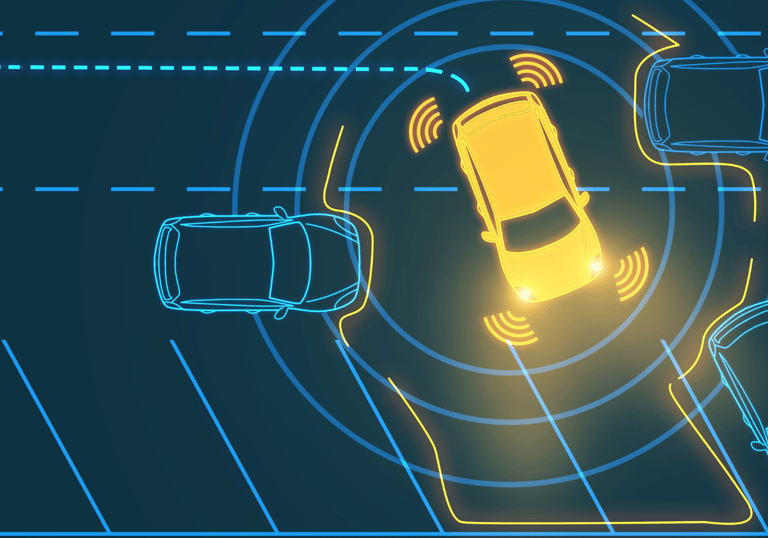
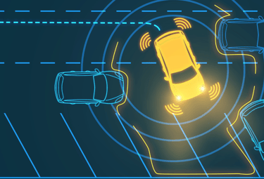
LiDAR (Light Detection and Ranging) sensors emit laser light pulses to measure distances by calculating the return time of the reflected pulse. This enables the creation of precise 3D maps and the detection of objects in the environment.
While conventional cameras provide a 2D image, making it difficult to obtain accurate information about distances and actual dimensions of objects, LiDAR emerges as a revolutionary technology. It offers a detailed 3D image of the surroundings of the sensor in real-time, making it a key element for the cities of the future.
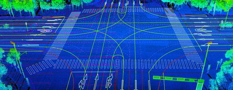
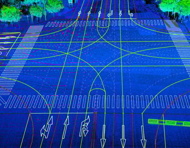
Image of a road-crossing generated from a LiDAR system.
SensorFlow Systems
At SensorFlow, we have designed equipment that incorporates LiDAR sensors, allowing real-time data collection from the environment where the system is installed. The systems are based on a modular design, enabling easy and efficient adaptation for various solutions (Click to learn about the main applications of SensorFlow equipment).
Power source
Depending on the project, the equipment can incorporate a high-capacity battery, harness solar energy through panels, or be directly connected to the local power grid.


Precision
Not all solutions require the same level of precision. Therefore, for more demanding cases, high-precision LiDARs can be incorporated to ensure reliable measurements with an error of less than 1 centimeter.
The collected data is processed to generate relevant information for our clients, using mathematical tools combined with AI (Artificial Intelligence).
Data processing